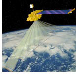


Space geodesy
Following the advent of space-borne Global Positioning System (GPS) that made possible point measurements of the Earth surface deformation with a sub-centimeter scale accuracy, the Interferometric Synthetic Aperture Radar (InSAR) avails mappping of surface deformation with unprecedented spatial coverage (tens of thousands of square km) and resolution (up to several m). As more satellites with InSAR capabilities will be launched into orbit, a high-resolution global geodetic monitoring will become a reality. My interests are in application of the InSAR techniques to studying deformation of the solid Earth due to various tectonic and man-made processes. Currently, we are using data collected by the ERS1/2 and Envisat satellites of the European Space Agency.
Recent work includes:
- Active magmatic diapirism in the Altiplano-Puna (South America)
- Deformation due to the 2010 M7.2 Durango (Mexico) earthquake
- Interseismic strain accumulation on the Southern San Andreas fault
- Deformation due to the 2003 Bam (Iran) earthquake
- Co- and post-seismic deformation due to the 1992 Landers earthquake
- Co-seismic strain localization on nearby faults
- Rupture characteristics of M7.1 Hector Mine earthquake from inversion of InSAR and GPS data
- Crustal uplift due to inflation of the Socorro Magma Body, New Mexico
- Magmatic unrest in the Long Valley caldera, eastern California
- Study of deformation in the Coso geothermal area, central eastern California
ROI_PAC / related software